Story
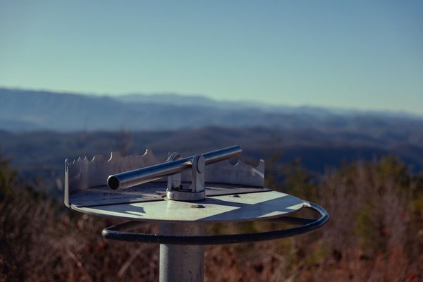
A Panorama of Peaks
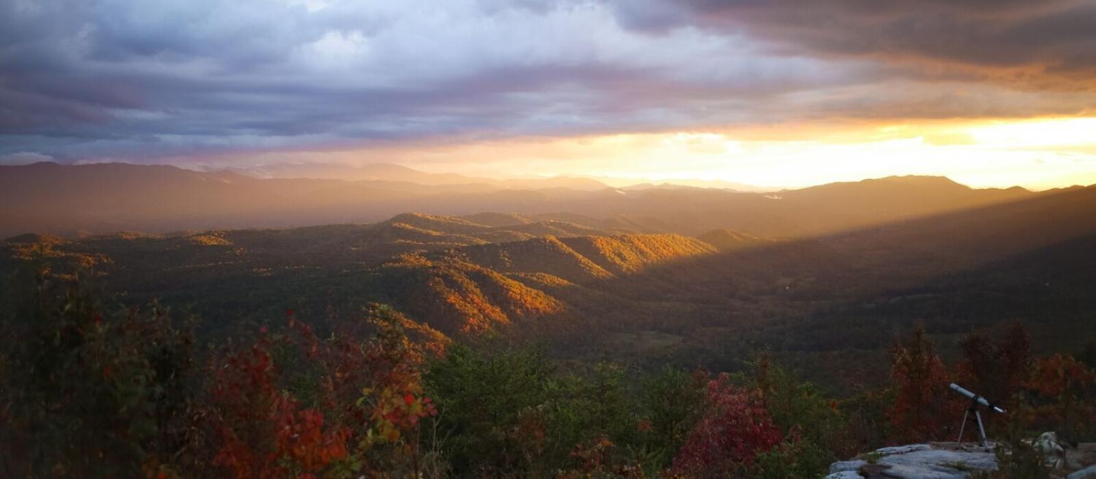
When you reach the height of Goat Hill on Blackberry Mountain, you’re greeted by a one-of-a-kind panoramic view of some of our area’s most stunning peaks and landmarks. At the Goat Hill Overlook, you can take a closer look at them using our viewfinder. Simply point the viewfinder in the direction of one of the 21 labeled arrows to discover multiple distinct views all from one spot!
Mt. Cammerer
Mt. Cammerer is located in the northeastern region of the Great Smoky Mountains along the Tennessee-North Carolina state line. Its summit tops out at nearly 5,000 feet, and features a western style fire tower accessible to hikers.
Mt. LeConte
At an elevation of 6,593 feet, Mt. LeConte is the highest peak located entirely in the state of Tennessee and the third highest peak in the Great Smoky Mountains National Park. Four major summits are connected along the main mountain range: Myrtle Point, High Top, Cliff Tops and West Point.
Cove Mountain
The Cove Mountain summit reaches 4,077 feet and features an old 60-foot fire tower that is used for monitoring air quality.
Mt. Mingus
Located in the Great Smoky Mountains National Park, Mt. Mingus peaks at about 5,800 feet.
Mt. Collins and Meigs Post
Mount Collins is located along the Tennessee-North Carolina border in the Great Smoky Mountains National Park. Its summit reaches 6,188 feet.
Kuwohi
Previously known as Clingmans Dome, Kuwohi - a Cherokee name meaning “mulberry place” - is the highest mountain in the Great Smoky Mountains National Park. Its peak of 6,644 feet is also the highest in the state of Tennessee and the third highest east of the Mississippi.
Rocky Mountain
Rocky Mountain is located in the Great Smoky Mountains in Blount County, Tennessee. Its elevation reaches 2,694 feet.
Listening Top. Cantle of Saddle Ridge
Listening Top is a mountain peak that reaches an elevation of 2,067 feet in Townsend, Tennessee.
Defeat Ridge
Defeat Ridge is a mountain ridge in the Great Smoky Mountains National Park that reaches an elevation of 4,951 feet. Its manway can be used to access Thunderhead Mountain.
Thunderhead Mountain
Located in the Great Smoky Mountains National Park along the Tennessee-North Carolina border, Thunderhead Mountain reaches an elevation of 5,527 feet, making it the highest point in Blount County.
Rocky Top and Blockhouse Mountain
At an elevation of 5,440 feet, Rocky Top is one of the three major peaks on Thunderhead Mountain. Blockhouse Mountain in Swain County, North Carolina, is a summit that peaks at 5,414 feet.
Spence Field
The grassy bald known as Spence Field is located in the Great Smoky Mountains along the Tennessee-North Carolina state line. Its elevation reaches around 4,900 feet, and the open meadow spans approximately 200 acres.
Rich Mountain Cerulean Knob
Cerulean Knob is the highest point on Rich Mountain in Blount County. Its summit tops out at nearly 3,700 feet.
Dry Valley
Dry Valley is a valley in Blount County Tennessee that reaches an elevation of 1,099 feet.
Gregory Bald
Gregory Bald is located entirely within the Great Smoky Mountains National Park and reaches an elevation around 4,950 feet along the Tennessee-North Carolina state border.
Sheep Pen Gap and Parson Bald
Sheep Pen Gap is a mountain pass in the Great Smoky Mountains at an elevation of 4,620 feet. It is located along the Tennessee-North Carolina border between Gregory Bald and Parson Bald at an elevation of 4,731 feet.
Unicoi Mountains
The Unicoi Mountains span over 1,000 square miles across the Tennessee-North Carolina state border and are named after the Cherokee term “unaka”, which means “white”. Peaking at 5,558 feet, Huckleberry Knob in Graham County, North Carolina, is the highest point along the range.
Blair Gap and Hurricane Mountain
Hurricane Mountain tops out at 2,038 feet in the foothills of the Great Smoky Mountains. Blair Gap Trail is located on the southeastern flank of the mountain.
Blackberry Farm
Blackberry Farm is nestled in the foothills of the Great Smoky Mountains with quick access to the national park.
Mount Nebo
Mount Nebo is a mountain in Walland, Tennessee, at an elevation of 1,988 feet.
Walland Gap
Walland Gap is a channel in the foothills of the Great Smoky Mountains that formed when the Little River cut through Chilhowee Mountain.